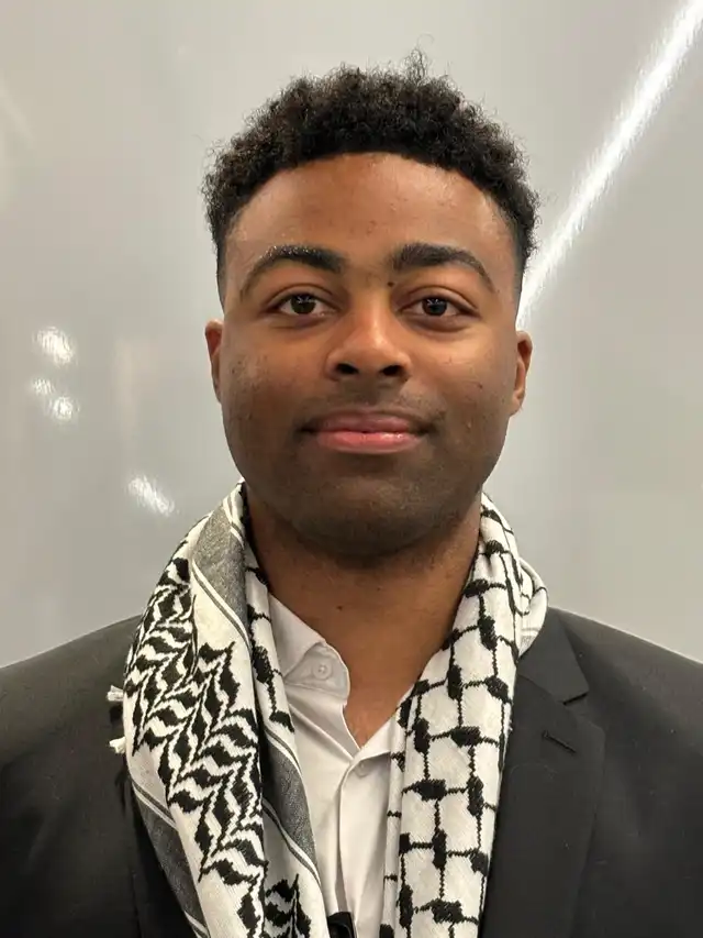
Eric Allen Jr.
Geospatial Analyst | Sudden Onset Emergencies Specialist | Operational Needs Assessments and Drones Specialist
5 yrs experience · Odenton, MD · <10 hrs/week
About
Welcome to my LinkedIn profile! I served as a Geospatial Developer and UAS focal point at the UN Office for the Coordination of Humanitarian Affairs (OCHA) with the Needs and Response Analysis Section (NARAS). Academically, I earned a master's degree in Human Security & Geospatial Intelligence (HSGI) at the University of Southern California, having previously completed my bachelor's degree in the same field. My professional journey includes a valuable GIS internship at the Pacific Disaster Center, where I honed my expertise in Esri's suite of products, with a particular focus on ArcGIS Pro, StoryMaps, and Dashboards. I significantly enhanced my data processing capabilities during this role by utilizing FME (Feature Manipulation Engine) and meticulously reviewed over 90 PDC-issued products for relevance, effectiveness, aesthetics, efficiency, and branding. Outside of my academic and professional pursuits, I have also excelled as an athlete, competing at the Division I level for USC. My achievements in this realm include multiple All-American honors and conference championships. My skill set encompasses a high level of proficiency in humanitarian emergency operations, including assessment and analysis, Coordination, Response Planning, and, of course, GIS. My passion can be summed up in one line: To serve the communities in need. Thank you for visiting my profile. I invite you to connect with me and explore potential opportunities for collaboration!
Skills
Experience
- Junior Geospatial Developer · United Nations OCHA2025-01-01 – 2025-07-01
• Successfully coordinated the interagency Assessment & Analysis (A&A) Cell during the March 2025 Myanmar Earthquake response, producing actionable information for planning figures and aid delivery for the humanitarian community. • Fulfilled the role of A&A Cell coordinator, leading interagency focal points to develop/revise guidance/SOPs/tools for four core thematic groups: Rapid Needs Assessments (RNA), Joint Analysis, Aerial Assessments, and Estimated Impact Analysis. • Supported MSNA’s and other needs assessments and analysis activities for all priority countries as part of the 2025 and 2026 Humanitarian Programme Cycle (HPC). • Served as OCHA Unmanned Aerial Systems (UAS) / Drones focal point and led an interagency working group to develop a harmonized aerial assessment methodology, standard operating procedures, and assessment tools. • Conducted flood analysis through satellite imagery for the 2024-2025 south-west Indian Ocean cyclone season for affected areas in Madagascar, Malawi, and Mozambique. • Provided country support to the Lebanon Information Management, EU ECHO, and UNOSAT to conduct satellite imagery assessment and analysis. • Provided hazard (natural and manmade) monitoring activity to all OCHA regional offices in preparation for potential sudden onset emergencies.
- Needs Assessment Consultant · United Nations OCHA2024-09-01 – 2024-12-01
- UNDAC Consultant · United Nations OCHA2024-02-01 – 2024-08-01
• Remotely coordinated the acquisition of Drone imagery captured in Grenada and St. Vincent and the Grenadines during the Hurricane Beryl emergency response mission for the UNDAC team and OCHA. • Developed a first-of-its-kind Guidance and standard operating procedure within OCHA for Aerial Assessment using drones, satellites, and manned aircraft for Humanitarian Rapid Needs Assessments in response to sudden-onset disasters for OCHA NARAS and UNDAC. • Conducted multiple proof-of-concept operations in Botswana, Republic of Korea, and Botswana with the focus on drones. In Botswana, I conducted multiple one square kilometer assessments with a DJI Mini 3 and processed the imagery within Site Scan for ArcGIS then later ArcGIS Pro. • Redesigned and delivered the UNDAC Induction course package in Gongju-si, Republic of Korea, serving as the focal point for creating and managing inject materials for the Desktop exercise. • Facilitated the inaugural SADC ERT Induction course hosted by SADC and the government of Botswana in Maun where I lead the Desktop Exercise and supported main exercise control for the simulated exercise. • Conducted a roster analysis of 500+ members of the UNDAC roster, with the results presented at the UNDAC Advisory Board meeting at HNPW. • Supported the MapAction Mapx simulated exercise in Castleton, UK, by managing the inject list, serving as the quality control focal point, and role-playing a few injects as the UNDAC team member.
- UNDAC Intern · United Nations OCHA2023-07-01 – 2023-12-01
• UNDAC Training & Coordination: Co-led the redesign and delivery of the UNDAC Induction course (Nov 2023, Senegal), developing new hazard/country scenarios and ArcGIS Pro maps. Coordinated daily exercise flow, scenario delivery, and role-played injects to support participant learning. • Emergency Response & Analysis: Operated the VOSSOC during the 2023 Libya Floods UNDAC mission and supported the JEU in hazard mapping (e.g., landmines). Provided recommendations to OCHA NARAS on optimizing aerial assessments for stakeholder needs.
- Global Operations Intern · PDC Global2022-06-01 – 2022-09-01
• Created new feature classes via request from customers to be integrated within DisasterAware and other software. Customers include USARPC, INDOPACOM through Pacific Endeavor, Eastern Caribbean Countries, and Hawaii. • Reviewed PDC issued products for relevancy, effectiveness, aesthetics, efficiency, and PDC branding; 90+ products reviewed. • Developed a cleaner presentation of PDC’s Big Data & Analytics, as well as country profiles using Esri products. • Successfully completed the entire internship 100% remote with a six hour time difference.
- VSFS - MapGive Intern · U.S. Department of State2020-09-01 – 2021-05-01
Education
- University of Southern CaliforniaBachelor of Science - BS, Human Security & Geospatial Intelligence
- University of Southern CaliforniaMaster's degree, Human Security & Geospatial Intelligence (HSGI)
Similar talent on Pangea
 Kenny B.Geospatial Analyst with Business Analytics ExpertiseCharlotte, NC
 Etien O.Geodetic Specialist | Geospatial Data ExpertTirana, Albania
 Aaron L.Design, Support, Planning and more!Elgin, IL
 Ginger D.Data Go-To, Operational Resilience and Preparedness Consultant, & Educator | I help teams analyze their data, crisis-proof their systems, & build unstoppable resilience so they don’t get derailed in chaos.Tucson, AZ
Hire Eric through Pangea
Describe your project to the Pangea agent — see if Eric is a fit, with transparent pricing and interviews booked straight onto your calendar. No contact details change hands until you hire.